Cinder Spur
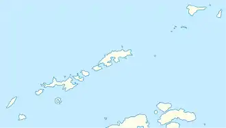
Der Cinder Spur (englisch für Aschesporn) ist ein schmaler Bergkamm an der Südküste von King George Island im Archipel der Südlichen Shetlandinseln. Er erstreckt sich 2,5 km westlich des Low Head in die Legru Bay.
| Cinder Spur | ||
|---|---|---|
| Lage | King George Island, Südliche Shetlandinseln | |
| Koordinaten | 62° 9′ 47″ S, 58° 11′ 18″ W | |
| ||
Das UK Antarctic Place-Names Committee benannte ihn 1963 so, da er vorwiegend aus vulkanischer Asche besteht.
Weblinks
- Cinder Spur im Geographic Names Information System des United States Geological Survey (englisch)
- Cinder Spur auf geographic.org (englisch)
This article is issued from Wikipedia. The text is licensed under Creative Commons - Attribution - Sharealike. The authors of the article are listed here. Additional terms may apply for the media files, click on images to show image meta data.
