Campbell Valley
Das Campbell Valley ist ein vereistes Tal mit ostwestlicher Ausrichtung im westantarktischen Marie-Byrd-Land. Es liegt zwischen der Hauptgruppe der Crary Mountains und dem Gebirgskamm Boyd Ridge.
| Campbell Valley | ||
|---|---|---|
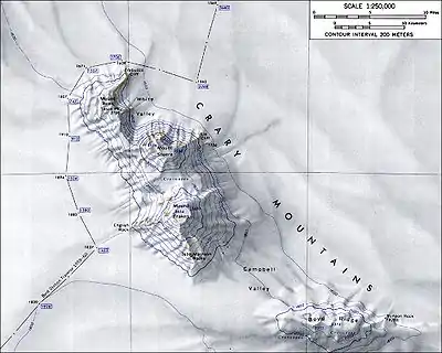 Topografische Karte der Crary Mountains mit dem Campbell Valley (Maßstab: 1:250.000) Topografische Karte der Crary Mountains mit dem Campbell Valley (Maßstab: 1:250.000) | ||
| Lage | Marie-Byrd-Land, Westantarktika | |
| Gebirge | Crary Mountains | |
| Geographische Lage | 76° 55′ 0″ S, 117° 40′ 0″ W | |
| ||

Der United States Geological Survey kartierte das Tal anhand eigener Vermessungen und Luftaufnahmen der United States Navy aus den Jahren zwischen 1959 und 1966. Das Advisory Committee on Antarctic Names benannte es 1967 nach Wallace Hall Campbell (* 1926), Ionosphärenphysiker auf Macquarie Island (1961–1962) und auf der McMurdo-Station (1964–1965).
Weblinks
- Campbell Valley im Geographic Names Information System des United States Geological Survey (englisch)
- Campbell Valley auf geographic.org (englisch)
This article is issued from Wikipedia. The text is licensed under Creative Commons - Attribution - Sharealike. The authors of the article are listed here. Additional terms may apply for the media files, click on images to show image meta data.