Birdwell Point
Der Birdwell Point ist eine Landspitze am nordwestlichen Ende der Dean-Insel vor der Hobbs-Küste des westantarktischen Marie-Byrd-Lands. Er ist vollständig vom Getz-Schelfeis umschlossen.
| Birdwell Point | ||
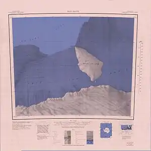 Topografische Karte von Dean Island mit dem Birdwell Point (Maßstab 1:250.000) | ||
| Geographische Lage | ||
| ||
| Koordinaten | 74° 18′ S, 128° 10′ W | |
| Lage | Dean-Insel, Westantarktika | |
| Gewässer | Getz-Schelfeis | |
| Gewässer 2 | Wrigley Gulf | |

Der United States Geological Survey kartierte ihn anhand eigener Vermessungen und Luftaufnahmen der United States Navy aus den Jahren von 1959 bis 1965. Das Advisory Committee on Antarctic Names benannte ihn 1974 nach Keith W. Birdwell, Elektrotechniker auf der Byrd-Station im Jahr 1969.
Weblinks
- Birdwell Point im Geographic Names Information System des United States Geological Survey (englisch)
- Birdwell Point auf geographic.org (englisch)
This article is issued from Wikipedia. The text is licensed under Creative Commons - Attribution - Sharealike. The authors of the article are listed here. Additional terms may apply for the media files, click on images to show image meta data.