Benedict Peak
Der Benedict Peak ist ein spitzer und hauptsächlich eisbedeckter Nebengipfel des Mount Murphy im westantarktischen Marie-Byrd-Land. Er ragt 10 km nordöstlich des Hauptgipfels auf.
| Benedict Peak | ||
|---|---|---|
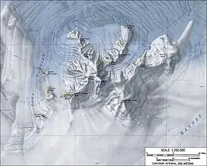
Topografische Karte des Mount Murphy mit dem Benedict Peak | ||
| Lage | Marie-Byrd-Land, Westantarktika | |
| Gebirge | Mount Murphy | |
| Koordinaten | 75° 17′ 0″ S, 110° 32′ 0″ W | |
| ||

Der United States Geological Survey kartierte ihn anhand eigener Vermessungen und Luftaufnahmen der United States Navy aus den Jahren von 1959 bis 1966. Das Advisory Committee on Antarctic Names benannte ihn 1967 nach Philip C. Benedict, Polarlichtforscher auf der Byrd-Station im antarktischen Winter 1966.
Weblinks
- Benedict Peak im Geographic Names Information System des United States Geological Survey (englisch)
- Benedict Peak auf geographic.org (englisch)
This article is issued from Wikipedia. The text is licensed under Creative Commons - Attribution - Sharealike. The authors of the article are listed here. Additional terms may apply for the media files, click on images to show image meta data.