Belousov Point
Der Belousov Point (englisch; russisch Мыс Белоусова Mys Beloussowa) ist ein eisbedeckte Landspitze an der Oates-Küste des ostantarktischen Viktorialands. Sie stellt den südlichen Ausläufer der Anderson-Halbinsel nördlich der Mündungszone des Suworow-Gletschers in die Somow-See dar und markiert östlich des Northrup Head die östliche Begrenzung der Einfahrt zum Whited Inlet.
| Belousov Point | ||
| Geographische Lage | ||
| ||
| Koordinaten | 69° 51′ S, 160° 20′ O | |
| Lage | Viktorialand, Ostantarktika | |
| Küste | Oates-Küste | |
| Gewässer | Somow-See | |
| Gewässer 2 | Whited Inlet | |
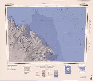
 Topografische Karte mit dem Belousov Point (unten) | ||
Teilnehmer der Zweiten Sowjetischen Antarktisexpedition (1956–1958) kartografierten das Gebiet im Jahr 1958 und benannten die Landspitze nach Kapitän Michail Prokofjewitsch Beloussow (1904–1946), Leiter der sowjetischen Polarflotte. Das New Zealand Antarctic Place-Names Committee übertrug die russische Benennung 1964 ins Englische.
Weblinks
- Belousov Point im Geographic Names Information System des United States Geological Survey (englisch)
- Belousov Point auf geographic.org (englisch)
This article is issued from Wikipedia. The text is licensed under Creative Commons - Attribution - Sharealike. The authors of the article are listed here. Additional terms may apply for the media files, click on images to show image meta data.
