Arkansas State Route 16
Die Arkansas State Route 16 (kurz AR 16) ist eine Ost-West-Richtung verlaufende State Route im US-Bundesstaat Arkansas.

| |
|---|---|
| Karte | |
 | |
| Basisdaten | |
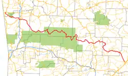
| Gesamtlänge: | 227,3 Meilen / 365,7 Kilometer |
| Anfangspunkt: | |
| Endpunkt: | |
| Wichtige Städte: | Fayetteville Clinton Heber Springs |
Die State Route beginnt am U.S. Highway 412 in Siloam Springs und endet in Searcy am U.S. Highway 67. Die Straße ist größtenteils eine ländliche zweispurige Straße. Sie trifft bei Fayetteville auf die U.S. Highways 62 und 71.
Weblinks
Commons: Arkansas State Route 16 – Sammlung von Bildern, Videos und Audiodateien
This article is issued from Wikipedia. The text is licensed under Creative Commons - Attribution - Sharealike. The authors of the article are listed here. Additional terms may apply for the media files, click on images to show image meta data.