Arkansas State Route 12
Arkansas State Route 12 ist ein in West-Ost-Richtung verlaufender Highway im US-Bundesstaat Arkansas.

| |
|---|---|
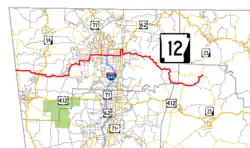
| Karte | |
 | |
| Basisdaten | |
| Gesamtlänge: | 56,6 mi / 91,1 km |
| Anfangspunkt: | |
| Endpunkt: | |
| Countys: | Benton County Madison County |
| Wichtige Städte: | Bentonville Rogers |
Der Highway beginnt an der Grenze zu Oklahoma, wo er zur Oklahoma State Route 116 wird, und endet östlich Clifty an der Arkansas State Route 23. Die State Route führt nördlich am Northwest Arkansas Regional Airport entlang, bevor sie in Bentonville auf den U.S. Highway 71 und die Interstate 540 trifft. Zwischen der Stadt Rogers und Clifty überquert sie den Beaver Lake.
Weblinks
Commons: Arkansas State Route 12 – Sammlung von Bildern, Videos und Audiodateien
This article is issued from Wikipedia. The text is licensed under Creative Commons - Attribution - Sharealike. The authors of the article are listed here. Additional terms may apply for the media files, click on images to show image meta data.