Arizona State Route 180A
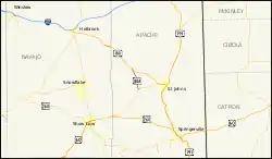
Die Arizona State Route 180A (kurz AZ 180A) ist eine State Route im US-Bundesstaat Arizona, die in Nord-Süd-Richtung verläuft.

| |
|---|---|
| Karte | |
 | |
| Basisdaten | |
| Gesamtlänge: | 11,18 mi/17,99 km |
| Anfangspunkt: | |
| Endpunkt: | |
| County: | Apache County |
Die State Route bildet die Verbindung zwischen der Kreuzung mit der Arizona State Route 61 in der Ortschaft Concho und dem U.S. Highways 180 südlich des Zuni Rivers. Die AZ 180A hat eine Gesamtlänge von 18 Kilometern.
Weblinks
Commons: Arizona State Route 180A – Sammlung von Bildern, Videos und Audiodateien
This article is issued from Wikipedia. The text is licensed under Creative Commons - Attribution - Sharealike. The authors of the article are listed here. Additional terms may apply for the media files, click on images to show image meta data.