Antelope Valley
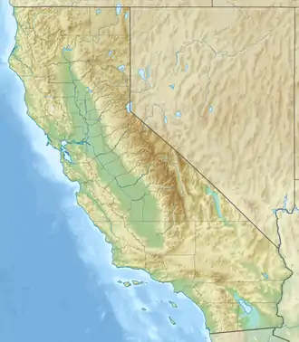
Das Antelope Valley („Tal der Antilopen“) befindet sich im Norden des Los Angeles County von Kalifornien und im Südosten des Kern County. Es repräsentiert auch den westlichsten Zipfel der Mojave-Wüste. Das Tal liegt zwischen den Tehachapi Mountains und den San Gabriel Mountains. Eingebettet liegen die verstädterten Gebiete von Palmdale and Lancaster.
| Antelope Valley | ||
|---|---|---|
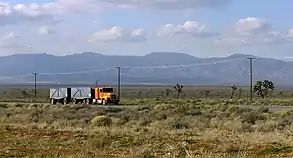 California State Route 58 im Antelope Valley California State Route 58 im Antelope Valley | ||
| Lage | Los Angeles County, Kern County in Kalifornien (USA) | |
| Gebirge | Tehachapi und San Gabriel Mountains | |
| Geographische Lage | 34° 45′ 5″ N, 118° 15′ 8″ W | |
| ||
| Fläche | 5700 km² | |
Das Tal wurden nach den Gabelantilopen benannt, die dort herumzogen, bis sie in den 1880er Jahren infolge schlechten Wetters und dauernder Bejagung ausstarben.
Weblinks
Commons: Antelope Valley – Sammlung von Bildern, Videos und Audiodateien
This article is issued from Wikipedia. The text is licensed under Creative Commons - Attribution - Sharealike. The authors of the article are listed here. Additional terms may apply for the media files, click on images to show image meta data.