All-Blacks-Nunatakker
Die All-Blacks-Nunatakker sind eine Gruppe markanter Nunatakker im Transantarktischen Gebirge. Sie liegen auf halbem Weg zwischen den Wallabies-Nunatakkern und den Wilhoite-Nunatakkern am Südostrand des Byrd-Firnfelds. Der Alexander Cone ist ein 1978 m hoher Berg in den All-Blacks-Nunatakkern westlich der Churchill Mountains.
| All-Blacks-Nunatakker | ||
|---|---|---|
| Lage | Australisches Antarktis-Territorium, Ostantarktika | |
| Teil des | Transantarktischen Gebirges | |
| ||
| Koordinaten | 81° 29′ S, 155° 45′ O | |
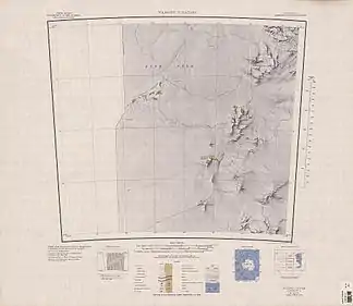
 Kartenblatt Wilhoite Nunataks von 1968, All-Blacks-Nunatakker östlich der Kartenmitte Kartenblatt Wilhoite Nunataks von 1968, All-Blacks-Nunatakker östlich der Kartenmitte | ||
Teilnehmer der New Zealand Geological Survey Antarctic Expedition (1960–1961) benannten sie nach den All Blacks, der Rugby-Nationalmannschaft Neuseelands.
Weblinks
- All-Blacks Nunataks im Geographic Names Information System des United States Geological Survey (englisch)
- All-Blacks Nunataks auf geographic.org (englisch)
This article is issued from Wikipedia. The text is licensed under Creative Commons - Attribution - Sharealike. The authors of the article are listed here. Additional terms may apply for the media files, click on images to show image meta data.
