‘Ado ‘Ale (Tadjoura)
‘Ado ‘Ale ist ein 1193 m hoher Berg in Dschibuti. Er liegt in der Region Tadjoura im Zentrum von Dschibuti.
| ‘Ado ‘Ale | ||
|---|---|---|
| Höhe | 1193 m | |
| Lage | Tadjoura, Dschibuti | |
| Koordinaten | 11° 56′ 22″ N, 42° 51′ 36″ O | |
| ||
Geographie
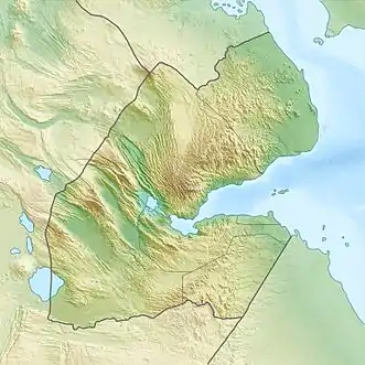
Der Berg erhebt sich nördlich des Ortes Tadjoura und südwestlich von Adailou im zentralen Teil von Dschibouti.[1] Weiter östlich erhebt sich der Gipfel des Kousra, südlich der Milaglé, westlich der Kasalto (1116 m) und nördlich der Dokotlé (1069 m).
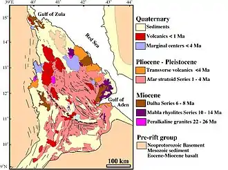
Geologie des Afar-Dreiecks.
Siehe auch
This article is issued from Wikipedia. The text is licensed under Creative Commons - Attribution - Sharealike. The authors of the article are listed here. Additional terms may apply for the media files, click on images to show image meta data.